Start (D)
Bus 304
Get off at: Hôpital
Timetable 304
End (E)
Bus 302
Get off at: Charrière
Timetable 302
Level of difficulty: quite easy
(possible with pushchairs or in winter using an alternative path from point 4 to point 7)
Distance: 10,97 km
Variation in altitude: +152 m; -186 m
Length: 3hrs
Altitude at start: 1039 m
Altitude at end: 1007 m
Highest point: Bulles south, 1067 m
Season: April-November or when there's no snow
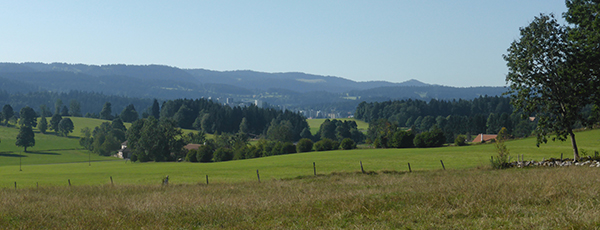
Panorama: various views of the La Chaux-de-Fonds valley, from the east
Refreshments:
Restaurant des Pervenches
Description of the path: from the Hospital (D), walk along the rue de Jérusalem (nice views of the east of the town) where Monique Saint-Hélier's novels were set, and cross the main road (1) to Belfort. Now you are in Les Bulles (2), where you will see several working farms and good views of the Franches-Montagnes and the Bernese Jura. At the junction (3), go left up to the farm named Haute Maison to enjoy a panorama of the Jura and even two Alpine peaks. Then you come to the Pervenches restaurant and the beginning of the Valanvron, which is popular with the townspeople for walks all year round. At the junction (4), continue along the road, which can be fairly busy, and get back on the path at (7). Go on through the fields, up a small hill (5). A little further on, you will see (6) the town stretched out ahead of you along the valley. Walk past the composting centre (8) to reach the cemetery (E), with its old crematorium, which is a masterpiece of Swiss Art Nouveau.
Download a PDF map
Watch the walk and its landscapes


